Biodiversity Blueprint and Strategic Plan
In 2009, Connecting Country developed a biodiversity blueprint to document the current health of the local landscape, and to guide the activities of ConnectingCountry in its formative. The activities were identified by interested local participants during the early consultation processes for in 2007-08. Funding and community support has since been obtained to implement many of these.

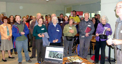
Standing room only at the launch of the Biodiversity Blueprint in 2009
The following downloadable documents have been taken from the Biodiversity Blueprint. Feel free to visit the Connecting Country office if you’d like to view a hard copy.
Section 1: What is Connecting Country (PDF)
Section 2: Biodiversity Blueprint Overview (PDF)
Section 3: Website and Interactive Mapping Tool (PDF)
Section 4: Maps (all jpg images)
Map 2: Pre-1750 Vegetation
Map 3: Current Vegetation
Map 4: Public and Private Land
Map 5: Conservation Significance
Map 6: Flora and Fauna
Map 7: Waterway Condition

Our mission is to connect country by drawing on the wealth of knowledge and experience in our community. We nourish and sustain the region of Mount Alexander by showcasing innovative possibilities of ecological land management. We aim to achieve this through a program of community engagement, landscape restoration, landcare support and monitoring and evaluation.
Map 8: On-ground Achievements
Map 9: Voluntary Conservation on Private Land
Map 10: Project Ideas – West
Map 11: Project Ideas – Central
Map 12: Project Ideas – East
Section 5: Guidelines for Consideration of Projects (PDF)
Since the release of the Biodiversity Blueprint, Connecting Country has grown rapidly as an organisation. As a result, there is more knowledge about the environmental threats and opportunities in the local area. New issues have also arisen that were not originally considered. As such, in 2014, there was an identified need to reconsider the role of Connecting Country and a new Strategic Plan was developed (2014-2024). A further review in 2025 refined our vision and goals for the next 10 years as outlined in our 2025-35 Strategic Plan.
Connecting Country Strategic Plan 2025-2035-Click here

